
















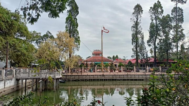
1. Bay Thua Base in the context of the Southern plains battlefield
Bay Thua Base is a historical địa danh (place name) associated with the anti-colonial uprising against the French led by Commander Tran Van Thanh in the late 19th century. The uprising took place in the context of the French colonialists having already controlled the entire Nam Ky Luc Tinh (Six Southern Provinces), prompting many local rebel forces to rise up and fight to protect their land and communities. Within that historical flow, Bay Thua became an important gathering point for the anti-French movement in the Southern plains region.

The space of Bay Thua Base is associated with the historical imprint of the resistance in the Southern Mekong Delta region. (Source: Collected)
Unlike many resistance bases formed in mountainous and forested areas, the Bay Thua Base is located in a vast delta space with intertwined rice fields, rivers, canals, and villages. This terrain characteristic creates a distinct type of battlefield, where military activities take place right within the living and production spaces of the people. This context clearly reflects how the anti-French movement in the South was closely linked to the daily lives of delta residents.
The terrain of the Southern Mekong Delta, with its system of canals, swamps, and muddy areas, presented both challenges and tactical advantages for the militia forces. The French army encountered considerable difficulties in deploying troops and controlling the area, especially when having to move through the complex network of rivers and canals. In this context, the Bay Thua Base served as a place for organizing forces, preparing logistics, and coordinating resistance activities during the turbulent late 19th century.
2. How Bay Thua Base Appears Through Its Canal System
2.1. Delta Terrain Creates a Unique Battlefield Setting
The terrain of the Tinh Bien area is characteristic of a delta region, with thick alluvial soil and a mix of natural and artificial canals. This creates low-lying areas that are prone to seasonal flooding but suitable for building flexible bases. When observing the actual site, it can be noted that the terrain does not have many high hills; instead, there are alternating low-lying strips, convenient for concealment and waterborne movement.
The combination of natural elements and human intervention through the canal system has created a highly dispersed terrain structure. This made it difficult for the enemy to approach and control the area. Therefore, the Bay Thua Base did not exist as a fixed location but was open, connected to the surrounding terrain network, forming a flexible operational space during wartime.
2.2. Surrounding Canals Aid in Identifying Defensive Lines
The canal system in this area not only served as transportation routes but also as natural defensive lines. The main and secondary canals intertwined to form a dense network, making land access difficult. When viewed on a topographical map, the canals surrounding the area that was once the base can be seen, forming "water belts" that served to obstruct and control movement directions.
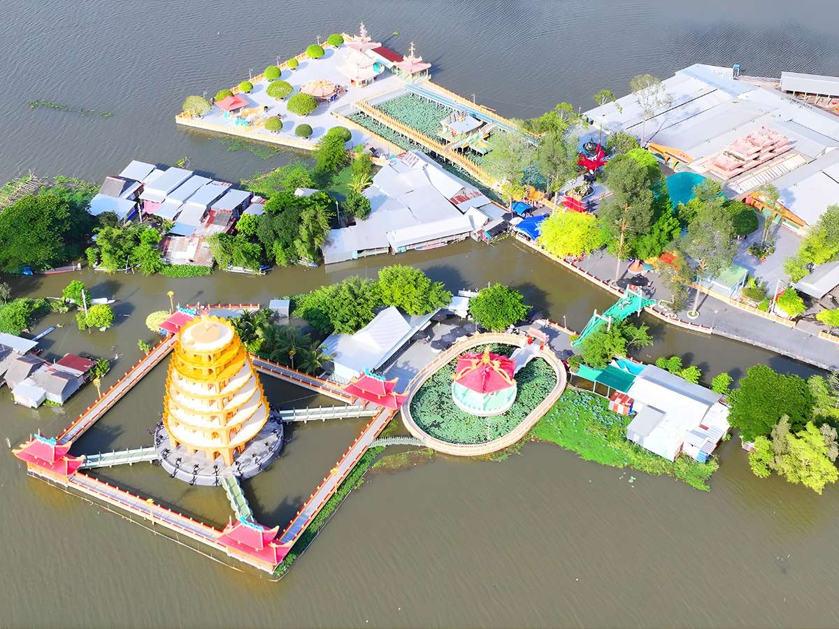
The system of canals and waterlogged terrain created a strategic advantage for the Bay Thua Base. (Source: Collected)
In reality, many documents record the utilization of canals for organizing blockades, observation, and communication between points within the base. This highlights the important role of hydrological factors in shaping defensive structures. The Bay Thua Base was therefore not just a geographical point but also a system connecting canals, reflecting how humans adapted to the environment for strategic purposes.
2.3. Remaining traces aid in reading the old story
Currently, the area that was once the base still retains some traces such as old earth foundations, canal remnants, and areas identified as former living quarters. These traces are not entirely intact, but they are sufficient to help visitors visualize the spatial organization of the past. Reading these traces requires a combination of field observation and historical understanding.
Local historical site conservation programs have contributed to preserving a part of the base's memory, while also providing information to visitors through introductory panels and documents. The Bay Thua Base therefore exists not only in books but is also recreated through its remaining traces, making the study of history more intuitive.
3. How to visit the Bay Thua Base from a historical learning perspective
3.1. Review character information before visiting the field
Before visiting, learning about the historical figures associated with the base helps readers better understand the base's role. This information may include names, positions, and contributions of individuals during their activity in the area. With basic knowledge, approaching the field will become more focused, avoiding fragmented observation.
Preparation also helps visitors connect small details at the site with the larger historical context. This is especially important when the traces are no longer intact, requiring observers to "read" the space based on known information. This approach turns visiting The Bay Thua Base into a historical learning process rather than just a site visit.
3.2. Observe the layout to visualize the base's scale
Upon arriving at the site, observing the overall layout helps visualize the scale and spatial organization of the base. Visitors can pay attention to the distribution of areas such as living quarters, movement routes, and points with clear traces. Although no longer complete as before, these elements still partially reflect the base's structure in the past.

The memorial at Bay Thua Base reflects historical value and revolutionary identity. (Source: Collected)
Combining direct observation with comparison to diagrams or previously researched documents helps to recreate the space more clearly. This is a method commonly applied in historical research in the field. **Bay Thua Base** in this case becomes a “living map,” where visitors can connect information points themselves to better understand how a base operated during wartime.
3.3. Reading the landscape around the stop according to the historical narrative
In addition to observing direct traces, the surrounding landscape also provides much information about how the base existed in the past. Factors such as water flow direction, tree locations, and distances between points can suggest how space was organized and daily activities were conducted. “Reading” this landscape requires imagination and an understanding of the area's natural conditions.
By combining landscape elements with historical information, visitors can visualize the base's development over time. This makes the visit more profound, moving beyond mere observation to understanding the meaning of each detail. **Bay Thua Base** therefore becomes an open learning space where history and geography are connected through practical experience.
4. 4. Appropriate stop duration when visiting Bay Thua Base
4.1. Spending more time at areas with clear traces
When allocating visiting time, priority should be given to areas with clear traces to allow for careful observation and full information recording. These points often contain many details that help recreate the historical space, thereby supporting a deeper understanding of the base's operations. Spending time here helps avoid missing important elements.
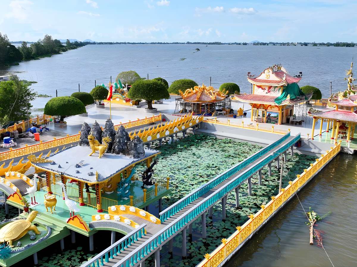
The surrounding riverine landscape gives Can Cu Bay Thua its characteristic Mekong Delta landscape features. (Source: Collected)
Furthermore, spending more time at key points also facilitates combining observation and note-taking, especially for those interested in research or study. Can Cu Bay Thua, with its remaining vestiges, demonstrates the value of preservation, while encouraging a slow approach to better understand the historical context.
4.2. Shorten travel time under sunny weather
The Southern Mekong Delta region has a climate with abundant sunshine, especially during the dry season months. Therefore, shortening travel time between points helps reduce the impact of the weather on the sightseeing experience. Visitors can choose cooler times of the day or arrange a reasonable itinerary to limit long journeys under the sun.
Adjusting the time not only helps ensure health but also maintains concentration when observing and seeking information. When not affected by the weather, knowledge acquisition will be more effective. This is especially important when visiting academic sites like Can Cu Bay Thua, which requires attention and detailed observation.
4.3. Allow time for nearby historical sites
Tịnh Biên and its surrounding districts have many other historical relics, creating opportunities to combine visits within the same itinerary. Allocating time for these sites helps broaden the perspective on the region's history and creates connections between landmarks. This helps visitors better understand the general context rather than focusing solely on one point.
When building an itinerary, time can be allocated by clusters of points to ensure each place is fully observed. This approach optimizes the experience without reducing the quality of information received. Can Cu Bay Thua, in this case, serves as a central point, connecting with other relics to create a systematic historical exploration journey.
Can Cu Bay Thua is a suitable destination for those who want to learn about the revolutionary history of An Giang associated with the Southern Mekong Delta landscape. The relic site evokes the fighting spirit and resilience of the local community through various historical periods. Alongside modern experiential tourist spots like Sun World Hon Thom, Can Cu Bay Thua contributes to recreating the historical context associated with the Southern Vietnamese riverine region.