















1. Chau Doc Floating Village and the living space on the Hau River
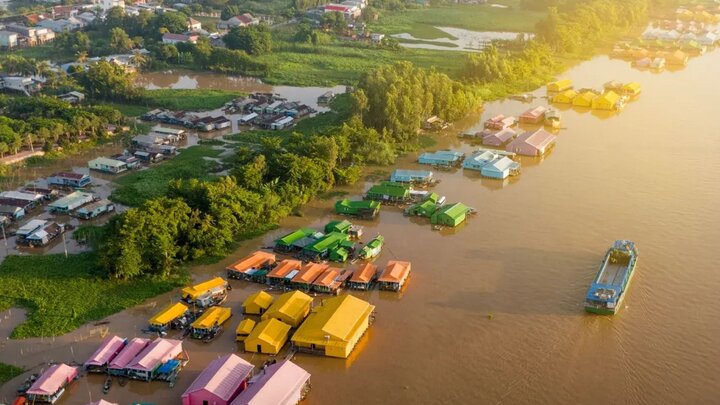
Chau Doc Floating Village is located downstream of the Hau River and near the old Chau Doc city, An Giang province. This is a community living on the water that formed in the 1960s, associated with raft cage fish farming rather than being built for tourism. The interconnected raft houses on the river reflect the long-standing livelihood of the local residents tied to the water.
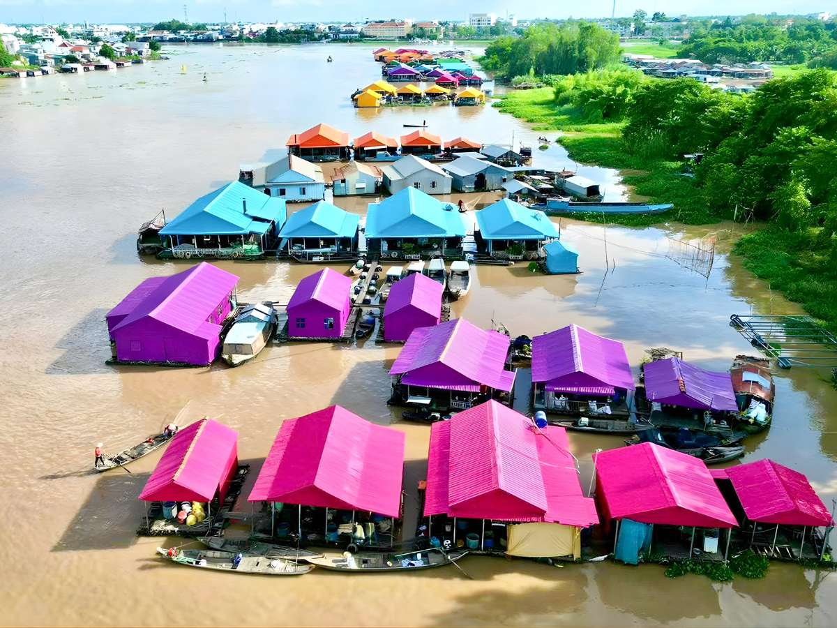
The floating villages of Chau Doc form a characteristic living space connected to the Hau River. (Source: Collected)
Houseboats, fish docks, and fish cages are arranged adjacent to each other, creating a characteristic living space of the Western river region. Life here takes place entirely on the river, from eating, trading, to daily movement by boat. The continuous presence of labor and daily activities creates a realistic portrayal of life, not a performance.
At the confluence of the Chau Doc River, the floating village appears as a close-knit community, where many generations live together and maintain fish farming. The construction of floating houses on the water and the habit of traveling by watercraft show the residents' adaptation to natural conditions. This space reflects the connection between people, the river environment, and local economic activities.
Although known to many tourists in recent years, the Chau Doc floating village maintains the daily rhythm of the local residents. People continue to farm fish, live, and travel on the river as a familiar part of life. It is this authentic daily life that creates the experiential value for those who want to deeply understand the river landscape of An Giang.
2. What to observe on-site at the Chau Doc floating village
2.1. Clusters of fish farming rafts creating a characteristic landscape
The fish farming raft clusters in the Chau Doc floating village are arranged in long rows, fixed on the river and connected by small walkways. Each raft serves as both a fish farm and a living space, creating a model that combines production and residence. According to records, the number of rafts increased significantly from the 1970s due to economic efficiency, making this area one of the province's important freshwater fish farming sites.
From a general perspective, the rafts arranged side-by-side form an image resembling a floating residential area stretching for many kilometers. When painted uniformly as part of a tourism project, the raft clusters become a highly organized, easily recognizable landscape structure from afar. This helps the floating village space transition from a purely production-oriented form to a combined tourism-experience form.
2.2. How residents live directly on the water surface
Life in the floating village takes place entirely on the river surface, from eating, resting, to daily communication. Residents use small boats to travel between rafts or to and from the shore, creating a rhythm of life dependent on the current and hydrological conditions. This model clearly reflects how riverine dwellers adapt to their natural environment.
In addition to fish farming, families also engage in small-scale trading or serve tourists. Some rafts are open for visitors to observe fish cages, feed the fish, or learn about the farming process. These activities occur alongside daily life, creating an interaction between local life and tourist experiences.
2.3. The river water color and the rhythm of passing boats
The color of the Hau River water in this area often changes with the seasons, from a deep muddy color during the flood season to a lighter hue during the dry season. This change directly affects the visual perception when observing the floating village, especially when combined with the colors of the raft clusters. This is a natural factor that creates differences between various times of the year for visits.
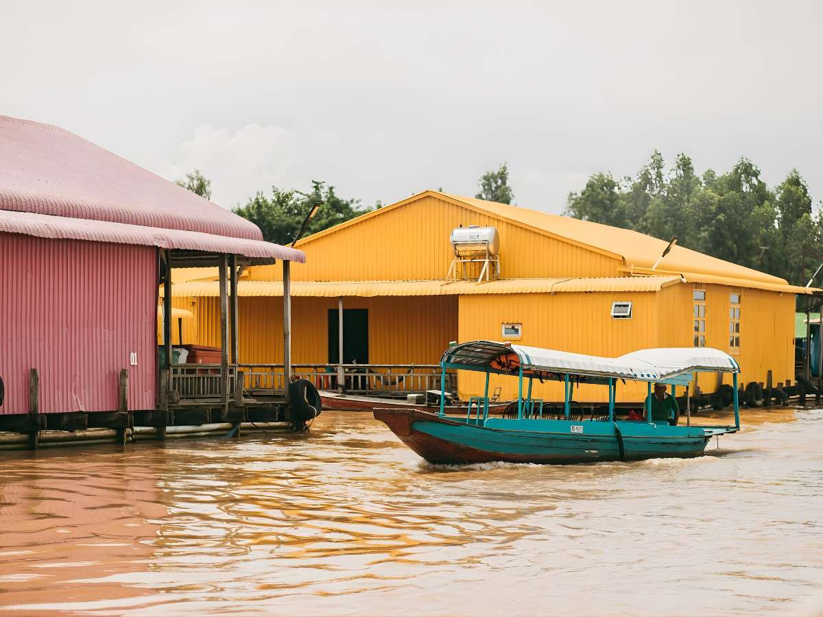
The structure of the floating village reflects how people organize their lives directly on the water. (Source: Collected)
Besides, the density of boats passing on the river contributes to forming the rhythm of the space. Transportation means for goods, fish fry, and essential supplies create a continuous flow of movement, reflecting the area's trading role. Observing this passage helps to better identify the connection between the floating village and the riverine economic system.
3. How does the tour of Chau Doc floating village take place?
3.1. Approaching the floating village by boat via a short route
Access to the floating village is mainly by boat departing from the pier in Chau Doc. The travel route usually lasts about 20–30 minutes, going along the Hau River and heading towards the river confluence. This is a common approach due to the dominance of the water surface and the lack of direct land routes to each cluster of rafts.
During the journey, visitors can gradually observe the appearance of raft clusters and the structure of the floating village. Traveling by boat provides a continuous viewing angle, from afar to up close, helping to visualize the spatial arrangement clearly. The short journey provides sufficient observational data on the landscape and activities on the river.
In addition to transportation, the short boat route also helps to control the sightseeing time within the day effectively. With a not-too-long distance, visitors can combine many other destinations in the same itinerary without disrupting the schedule. This is suitable for the route-based tourism characteristics in Chau Doc, where attractions are often linked by waterways.
3.2. Sailing along the raft clusters to clearly see the floating village structure
After approaching, the boat usually moves slowly along the rows of rafts for detailed observation. At close range, one can clearly see each fish cage, the raft floor structure, and the arrangement of houses on the water. This helps to clearly identify the floating village model with closely linked elements among each household.
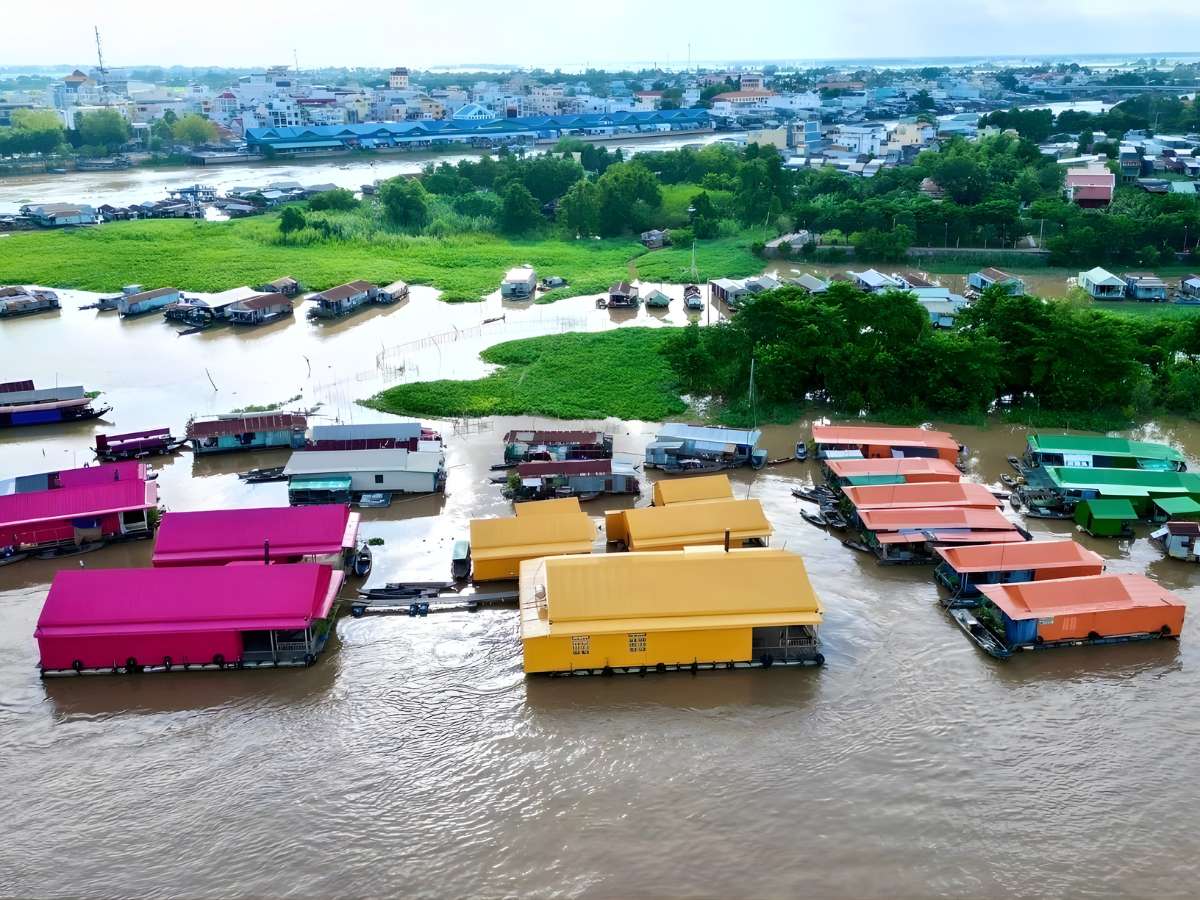
The raft village space has become a typical attraction for the riverside life of Chau Doc. (Source: Collected)
Moving along the raft clusters also allows observation of changes in color, density, and scale of each area. Some sections have more rafts concentrated, creating a dense feeling, while other sections are more spacious. This distribution reflects the uneven development process of the raft village over time.
Furthermore, the process of moving along also helps recognize differences in spatial organization between the raft clusters. Some areas have a relatively uniform arrangement, while others have developed more spontaneously. These differences provide further insight into how residents adapt to flow conditions and production needs at different times.
3.3. Stop at open sections to photograph the entire river surface
In wide river sections, boats often stop to observe the panoramic view. From this position, one can see the entire extended raft line, combined with the water and sky, forming a continuous scene. This is the perspective that best identifies the spatial structure of the Chau Doc raft village.
The open space also highlights the contrast between the colors of the rafts and the river water. When lighting conditions are favorable, the raft rows appear clearer, making observation and image capture more convenient. This explains why stops in the middle of the river are often chosen during tours.
Besides observational value, stopping at open sections also helps assess the overall density and scale of the raft village. From a broad perspective, one can discern how raft clusters are distributed along the flow and the distances between areas. This provides a more comprehensive view compared to observing at close range during movement.
4. When is the Chau Doc raft village experience clearer?
4.1. Early morning allows for calmer river movement
Early morning typically has lower boat traffic, resulting in less turbulent water. This creates favorable conditions for boat travel and reduces the impact of waves on the raft clusters. In a context where raft villages depend on natural conditions, water stability plays a crucial role in the visiting experience.
In addition to traffic factors, morning light also enhances the clarity of the scenery. When the light is not too harsh, the colors of the rafts and the water surface are displayed more clearly. This aids in observing the structural elements and activities on the river in detail.
4.2. Good sunlight helps clearly see the water color and floating rafts
Periods with stable sunlight during the day help highlight the contrast between the water color and the raft colors. The colors painted on the rafts become more prominent under direct light, facilitating the overall perception of the space. This is an important factor in observing the highly visual landscape of the area.
Furthermore, good lighting also helps in clearly observing daily activities and production. From feeding fish to moving between rafts, all details are easier to observe when lighting conditions are suitable. This makes the visiting experience more complete and continuous.
4.3. Periods with fewer large boats passing create a smoother visiting experience
Times with fewer large boats moving reduce the disturbance of the current, thus creating a stable feeling when visiting by boat. Large waves from transport vehicles can affect observation and movement, especially in narrow river sections. Therefore, choosing the right time makes the experience more convenient.
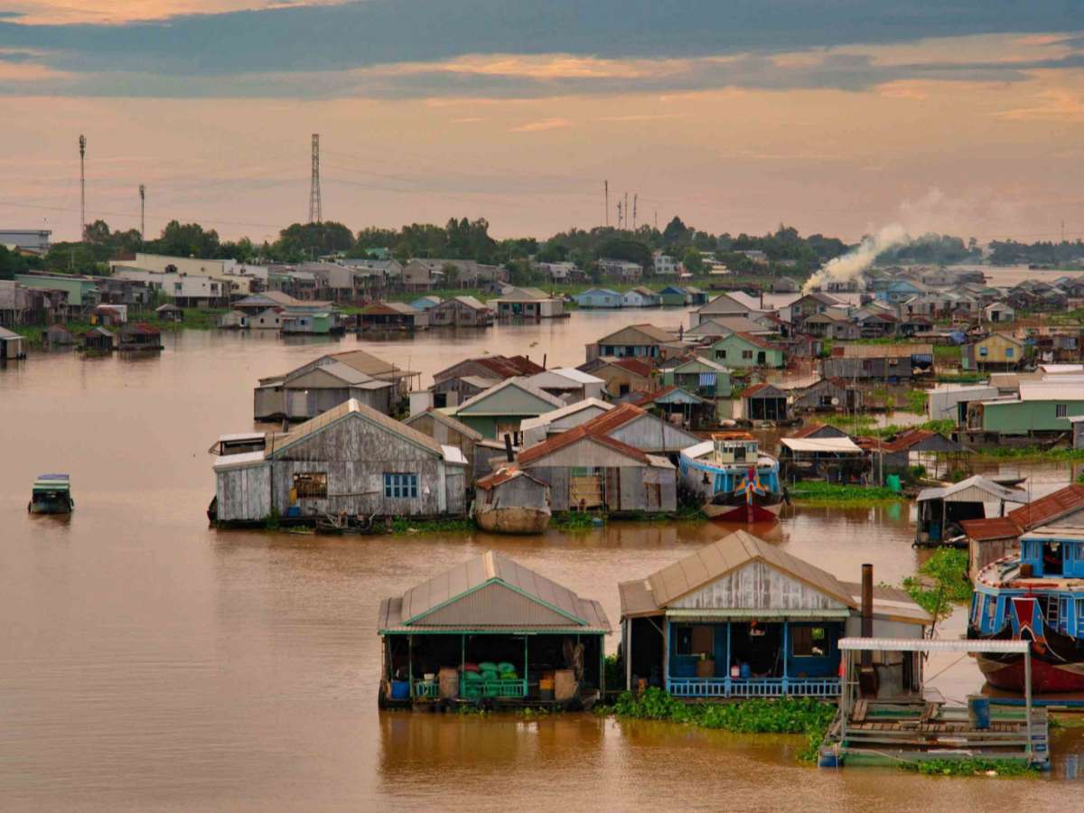
Visiting floating villages by boat helps to fully experience the riverine way of life. (Source: Collection)
When the space is less affected by traffic, natural elements and the daily life of the floating villages are more clearly expressed. This helps observers focus on the structure of the floating village, colors, and local rhythm of life. The stability of the surrounding environment plays an important role in fully capturing the characteristics of the area.
Chau Doc floating village is a suitable destination to clearly feel the river life of the Mekong Delta through daily activities and fish farming on the river. While Sun World Hon Thom represents a concentrated tourism model, Chau Doc floating village shows how local people connect their lives with the river.