















1. Iconic Mark of the Y-shaped Bridge An Giang in the Urban Space
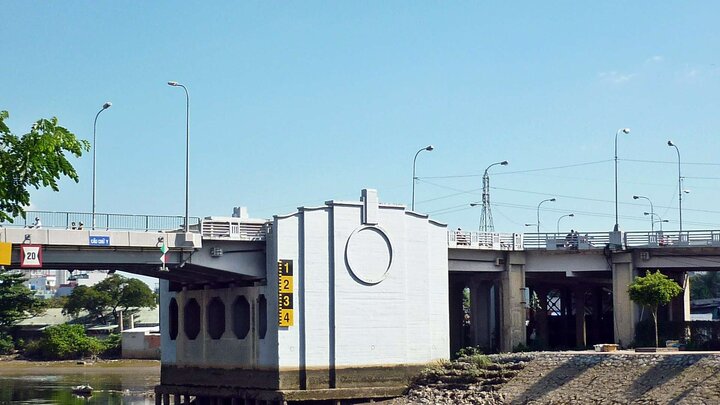
The Y-shaped Bridge An Giang is the familiar name locals use for a bridge with a branching structure, resembling the shape of a Y when viewed from above. The bridge is located in the inner city area, serving to connect riverside traffic routes and nearby residential areas. This structure primarily serves the daily travel, transportation, and living needs of the people.
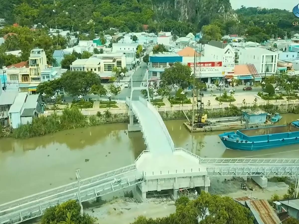
The An Giang Y-shaped bridge creates a unique architectural highlight amidst the riverine urban space. (Source: Collected)
From an architectural perspective, the Y-shaped bridge has an uncommon form in the Mekong Delta region, where most bridges have simple straight or curved designs. The branching structure allows vehicles to be directed separately right on the bridge deck, suitable for the interlaced canal characteristics of the riverine area. This very element makes the bridge easily recognizable in the urban landscape.
Amidst the intertwined urban and riverine landscape, the An Giang Y-shaped bridge is not just transportation infrastructure but also contributes to creating a riverside scenic highlight. The area around the bridge has a moderate construction density, maintaining the necessary openness for visibility. Thanks to this, the bridge has gradually become known as a familiar spatial landmark in the city experience.
2. From Which Positions Should the An Giang Y-shaped Bridge Be Observed
2.1. Bridge Ends Offer a Complete View of the Structure
When standing at the bridge end, observers can clearly see the characteristic branching structure of the work. This is the position that allows for the most intuitive recognition of the Y-shape, especially when traffic is not too heavy during early morning or late afternoon hours. The perspective from the bridge end allows observation of the branches extending in three directions, while also clearly demonstrating the connecting role between roads in the area.
With this characteristic, many people choose the bridge end position to capture the overall image of the structure. Besides the shape, the bridge end is also where the intersection between residential areas and transportation spaces is clearly shown. Daily activities such as moving vehicles, people commuting, or small vehicles create a vivid picture. This reflects the urban characteristics of the delta provinces, where transportation and life are intertwined. Observing from the bridge end helps to better understand how the structure is used in practice.
2.2. The Middle of the Bridge Opens Up a Wider View Down to the Water
The middle section of the bridge offers a wider perspective, especially looking down at the water below. From this position, observers can clearly see the currents, small watercraft, and the characteristic riverine landscape of the area. This point helps balance the structure with nature, as the bridge is no longer just infrastructure but becomes part of the scenery. With the bridge's length sufficient to create distance from both ends, the middle section usually has a more open view.
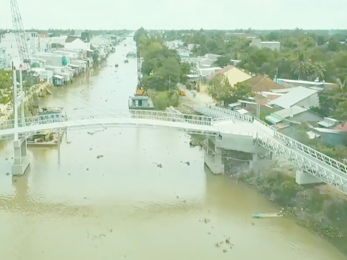
Experience walking and taking photos on the Y-shaped bridge amidst the landscape of rocky mountains and water. (Source: Collected)
Furthermore, the view from the middle of the bridge reveals the contrast between the movement of vehicles and the relative tranquility of the water surface. This creates a multi-dimensional observation experience, reflecting the rhythm of urban life along the river. At different times of the day, the changing light also makes the landscape at this location more diverse. This is one of the points that many people pay attention to when looking for a panoramic view.
2.3. The end of the bridge is suitable for taking photos along the extended axis
The end of the bridge provides a perspective along the length of the structure, emphasizing the sense of spatial depth. Standing here, observers can look down the bridge axis, clearly seeing the gradual narrowing of lanes and moving vehicles. This is a perspective often chosen when wanting to express the continuity of traffic and road structure. With this composition, the image creates a sense of depth and clear direction.
Additionally, the end of the bridge allows for the incorporation of surrounding elements such as houses, trees, or connecting roads. This helps the image focus not only on the bridge but also reflect the overall urban space. The combination of architecture and living environment creates a highly descriptive perspective, suitable for documenting regional characteristics.
3. What can you experience at the Y-shaped bridge?
3.1. A short walk to feel the rhythm of urban life by the river
Walking on the bridge offers a direct experience of the rhythm of life in the riverside area. Pedestrians can clearly feel the change in space as they move from the beginning to the middle of the bridge, where the view expands and the air becomes more open. This activity is not long but is sufficient to observe elements such as traffic, scenery, and daily life. This is a simple yet clear reflection of the urban characteristics in An Giang.
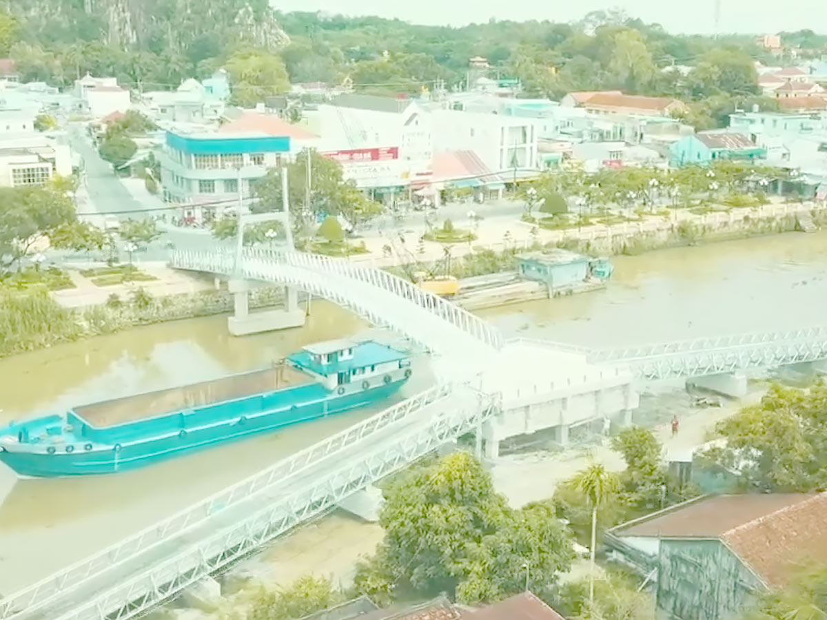
The Y-shaped bridge is a flexible stopover point, connecting sightseeing and day-tripping. (Source: Collected)
Furthermore, walking helps to clearly recognize how the Y-shaped bridge An Giang is integrated into the living space. Elements such as the sound of vehicles, wind from the water surface, and natural light create a distinctive environment. This differs from the experience of fast travel by vehicle, where participants have fewer opportunities to observe details. Walking helps enhance the ability to perceive and record the space.
3.2. Photographing the structure in a riverine landscape
The bridge combined with the riverine landscape creates a characteristic image composition. When photographed from different angles, observers can exploit the contrast between the concrete structure and the natural space. This is an element that often appears in images of the Mekong Delta, where rivers play an important role in life. Choosing the right angle helps highlight the structure's shape.
Beyond technical factors, photography also reflects how people interact with space. Frames can include vehicles, pedestrians, or scenes of riverside life. This creates a multi-dimensional image, not just focusing on architecture but also reflecting life. The combination of these elements makes the image more descriptive.
3.3. Observing the flow of traffic as part of daily life
The flow of traffic on the bridge clearly reflects the daily rhythm of the area. The main vehicles are motorbikes, bicycles, and some other small vehicles, creating a stable traffic volume throughout the day. Observing the traffic flow helps identify peak and off-peak times, thereby better understanding people's travel habits. This is an important factor in assessing the bridge's role in the transportation system.
In addition, traffic activities are also linked to small-scale economic activities such as roadside vending. This creates a characteristic picture of life, where traffic and daily life are inseparable. Observing traffic flow is not just about watching movement but also a way to understand the local social structure.
4. What makes the Y-shaped bridge An Giang most attractive to tourists?
4.1. The structure's shape makes it recognizable from afar
The Y-shape design is what makes the structure easily recognizable in the urban landscape. When viewed from afar or from above, the branching shape creates a clear visual cue. This helps residents and visitors easily identify the bridge's location within the overall area. In urban planning studies, structures with distinctive shapes often serve as spatial landmarks.
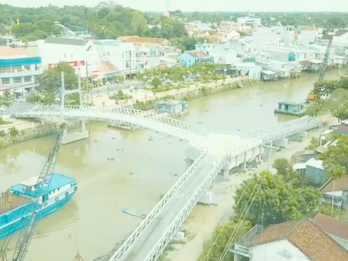
Visit the Y-shaped bridge in the early morning or late afternoon to enjoy the harmonious scenery. (Source: Collected)
Furthermore, this shape also brings value in terms of traffic organization. The branching helps reduce pressure on concentrated routes, while creating multiple directions of movement. This is suitable for the characteristics of an expanding urban area, where the need for connectivity is increasing. The combination of function and form makes the structure more prominent.
4.2. The water surface view makes the landscape less cramped
The presence of the water surface below the bridge helps expand the sense of space. When looking down from the bridge, observers can clearly see the difference between the built-up area and the natural area. This reduces the cramped feeling often found in densely populated urban areas. The water surface acts as a visual void, helping to balance the spatial composition.
Moreover, the water element also contributes to environmental regulation and creates landscape diversity. In riverside cities, the combination of structures and nature is an important factor. This affects not only aesthetics but also the quality of life for residents. Utilizing the water surface makes the space more pleasant.
4.3. Short promenades suit city schedules
The length of the bridge allows for a short journey that is sufficient to experience the space. This is suitable for urban commuting schedules, where time is often limited. Participants can spend a short period walking, observing, and returning without affecting other activities. This is a factor that makes the structure convenient to access.
Additionally, short promenades are also suitable for the daily life of local residents. Activities often happen quickly, related to daily commuting and work needs. Having a space that can be experienced in a short time increases flexibility. This contributes to making the Cau Chu Y An Giang a readily accessible point in the urban context.
The Cau Chu Y An Giang is a symbolic stopping point, where tourists can observe the city from a perspective close to river life. Viewed from an urban landscape perspective, the Cau Chu Y An Giang has a very different character compared to the familiar island and sea imagery of Sun World Hon Thom.