















1. History of Sap Mountain's Formation and Landscape Changes
Sap Mountain is a mountain located in Thoai Son commune, An Giang province, in the Mekong Delta region. Previously, this place was a rock hill with a unique shape, about 85m high above sea level and with a circumference of about 3,800m, rising amidst the lowlands of the Southwest region of Vietnam. The location and terrain structure have helped Sap Mountain become a familiar landmark of the Thoai Son area for many years.
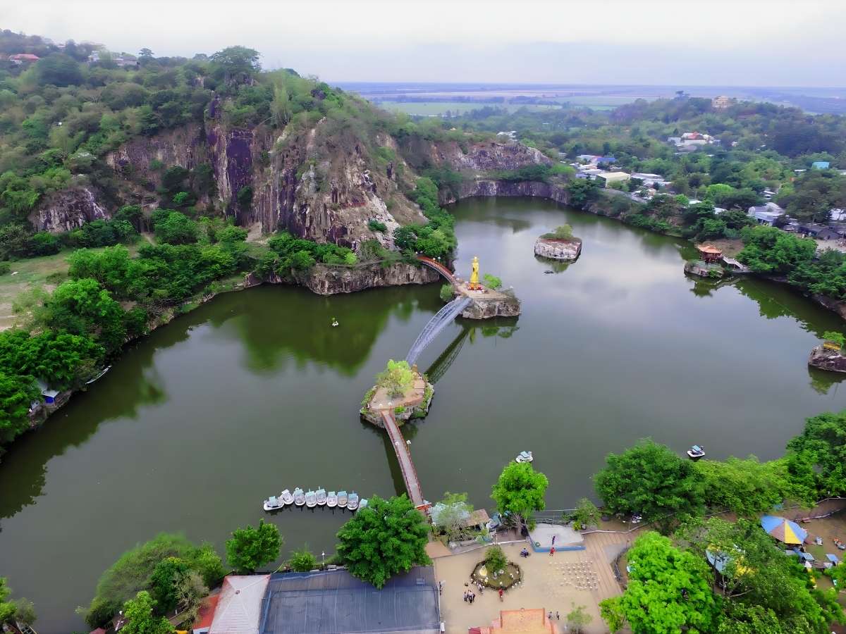
The Nui Sap space clearly shows the imprint of the formation of rocky terrain in the An Giang plain. (Source: Collected)
Among the mountain cluster comprising Nui Sap, Nui Nho, Nui Ba, and Nui Cau, Nui Sap is considered the largest and most recognizable mountain. The presence of this mountain cluster has contributed to creating a characteristic landscape in the vast surrounding plain space. Over time, the image of Nui Sap has become associated with the production, daily life, and memories of the local people.
The economic development process has caused the Nui Sap area to undergo many noticeable landscape changes. Stone quarrying activities have taken place for a long time, mainly concentrated at the foot of the mountain and in the surrounding areas. This has gradually altered the original shape of the mountain, creating deep pits and causing the natural appearance to no longer be in its previous state.
2. What attractions does Nui Sap have today?
2.1. The lake area creates a wide open space in the center
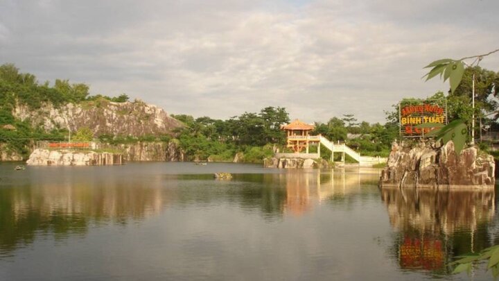
The lake area at Nui Sap was formed from old quarry pits, then was renovated into a system of lakes with an area of about 9 hectares, divided into many interconnected areas. Ong Thoai Lake is the most prominent part with its wide water surface, surrounding the foot of the mountain, creating an airy space in the center of the tourist area. This landscape clearly reflects the transition from resource exploitation to ecological tourism development.
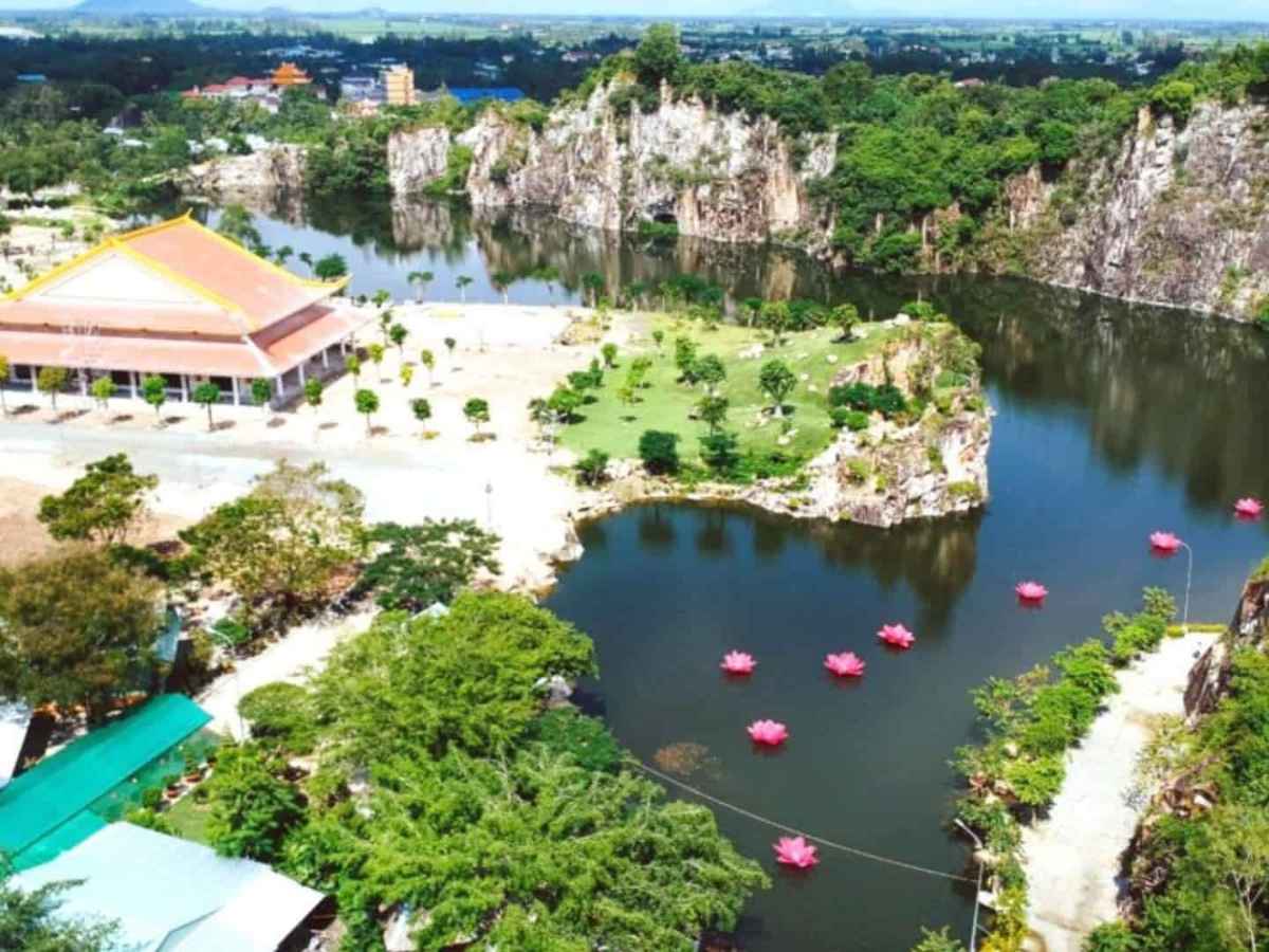
The remaining lakes and cliffs reflect the landscape transformation process during urbanization. (Source: Collected)
Around the lake are structures such as Mai An Tiêm bridge, Khoa Bảng bridge, and Vọng Nguyệt bridge, connecting the rocky outcrops and creating a continuous sightseeing route. Besides landscape elements, the lake area is also associated with the statue of Thoại Ngọc Hầu and the Thoại Sơn stele, contributing historical value to the space. The wide water surface combined with the rocky terrain creates a clear contrast between natural and artificial elements.
2.2. Open park area for outdoor strolls
The park area at Núi Sập is planned with an open concept, utilizing the space around the lake and the foot of the mountain to create walking paths and resting areas. The walking routes are designed to meander around the lake, connecting to attractions and facilitating easy movement by simple means like walking or cycling. This space is suitable for outdoor sightseeing and accessing natural landscapes.
Trees are planted along the routes, helping to reduce temperature and provide shade in the Mekong Delta climate. Additionally, resting areas, stone benches, and open spaces are distributed evenly, helping to maintain a stable sightseeing pace. The development of the park shows a trend of transformation from an exploitation space to a space serving community life and tourism.
2.3. High area offering panoramic views
The high area of Núi Sập allows for panoramic observation of the surrounding plains, including rice fields and residential areas in Thoại Sơn district. With an altitude of about 85m, the terrain is not too steep but sufficient to create a wide viewing angle, especially in clear weather conditions. This is one of the attractive factors for tourists seeking natural observation points.
Paths leading to the high area are usually built with stone steps or improved trails, making access more convenient than the original terrain. From this vantage point, one can clearly see the combination of the lake, the park, and the residential area, reflecting the overall spatial structure of the tourist area. The wide view also shows the connection between the mountain and the surrounding plains.
3. What activities should be experienced at Núi Sập
3.1. Walking around the lake on an accessible route
Walking around the lake at Núi Sập is a popular activity due to the continuous and relatively flat design of the walking paths. This route connects bridges and scenic areas, allowing for easy movement without requiring special skills. It is a suitable form of sightseeing for many age groups and does not depend on complex transportation.
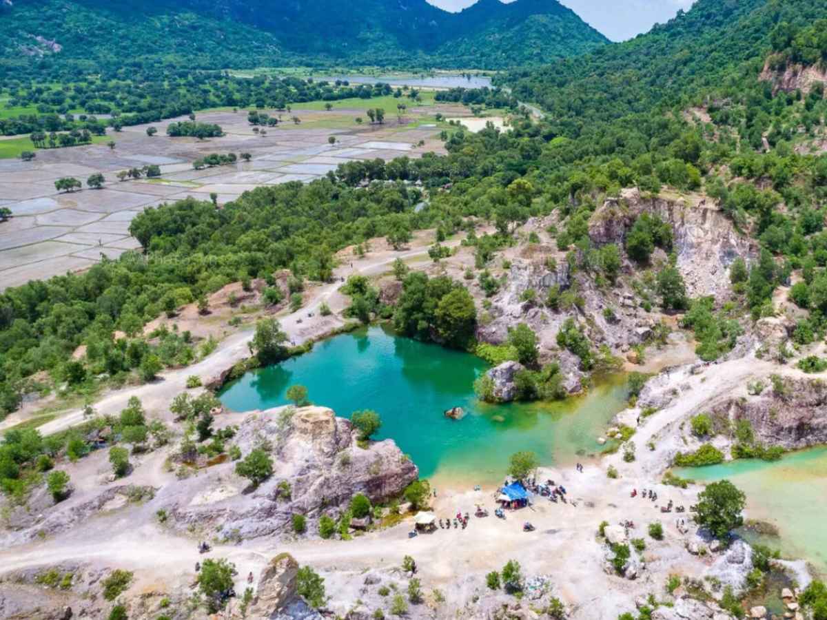
The ground-level view helps to clearly perceive the rock mountain structure and its interaction with surrounding life. (Source: Collected)
During the movement, visitors can observe the changing landscape along each section of the road, from the wide lake area to the rocky outcrops and green trees along the shore. This activity also clearly reflects the spatial organization of the tourist area, as routes are arranged to optimize accessibility and disperse visitor flow. This contributes to maintaining a stable experience throughout the journey.
3.2. Enjoying the scenery from wide vantage points
Sightseeing at Nui Sap typically takes place at high positions or open spots near the lake, where the combination of mountains, water, and plains can be observed. These locations are chosen based on natural topography and are supplemented with small structures to support the view. This activity is suitable for observing the overall space.
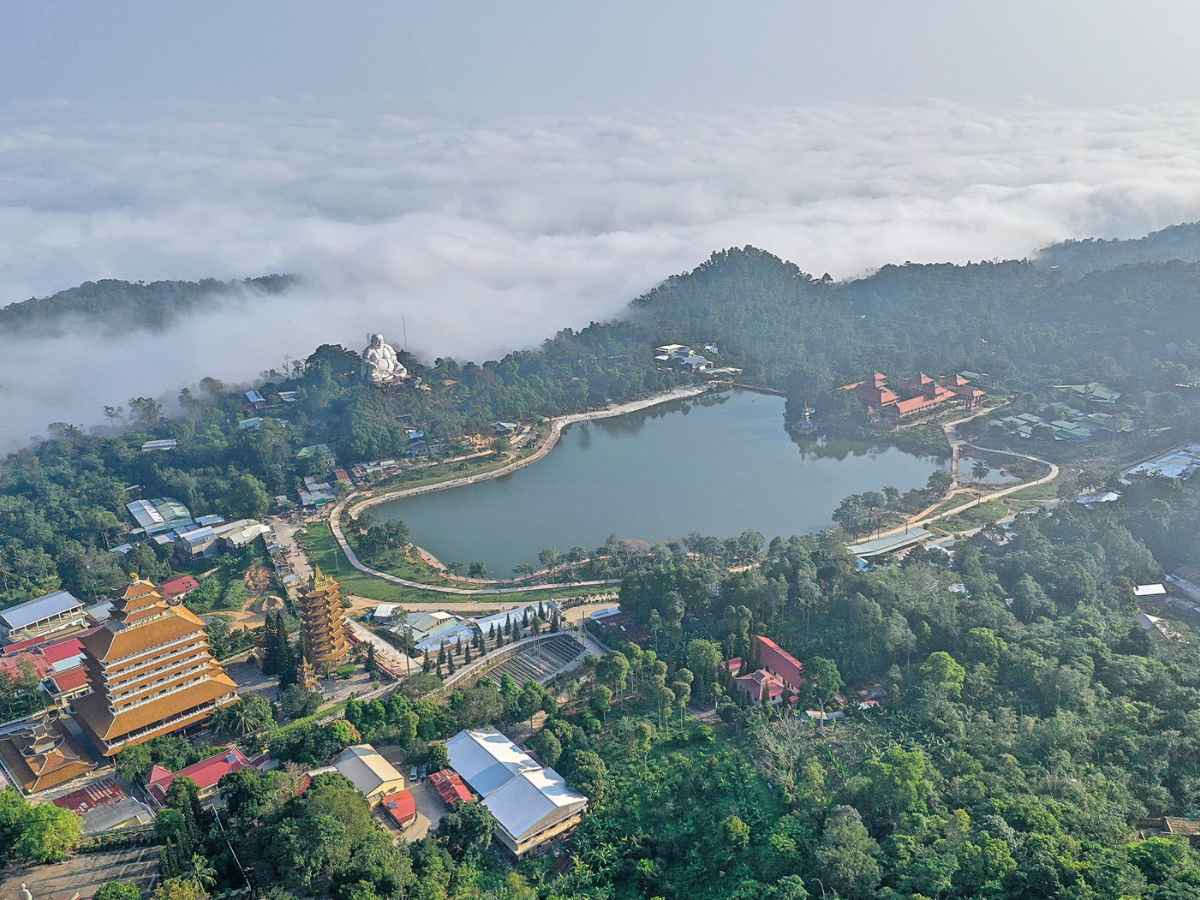
Nui Sap carries symbolic value associated with local memory and the process of land opening. (Source: Collected)
From high points, the clear distribution of functional areas such as the lake, park, and surrounding residential areas can be observed. This helps visitors better understand the spatial organization and landscape transformation of the area. The wide view also provides opportunities to observe the changes in light throughout the day.
3.3. Taking photos in open spaces
The open spaces at Nui Sap are formed by the combination of the lake, bridges, and natural rock surfaces. These areas have clear scenery and are not heavily obscured, making them conducive to photography. The diversity of viewpoints allows for the creation of various frames within the same area.
In addition to natural elements, structures such as bridges and statues also serve as focal points in the image composition. The arrangement of these elements at appropriate distances helps maintain a balance between empty space and focal points. This reflects how the planning aims to serve the need for capturing images during the visit.
4. Extended tour routes from the Nui Sap area
4.1. Extending the route to Ho Ong Thoai with a short travel distance
Ho Ong Thoai is located adjacent to the central area of Nui Sap, forming a continuous tour route with a short travel distance. This area is both part of the landscape and an independent point that can be accessed separately. The connection between the mountain and the lake helps create a closed tour route, convenient for short trips.
Here, besides the water landscape, there are also structures such as the statue of Thoai Ngoc Hau and stone steles recording the land reclamation process. These elements add historical depth to the tour, helping visitors better understand the context of the area's formation. The combination of natural and historical elements creates continuity in the experience.
4.2. Extending the route into the nearby Thoai Son central area
The Thoai Son central area is located near Nui Sap, serving as a connection point between the tourist area and the residential area. As the administrative center of the district, this area has a relatively complete transportation and service system. Extending the tour into the center helps broaden the scope of experience beyond the natural landscape.
Here, visitors can observe the cultural intersection between different resident communities, reflected in their architecture and daily activities. This area also reflects the role of Nui Sap as a center not only for tourism but also for the local economy and culture. The connection between the two areas helps create a more diverse visiting structure.
4.3. Extending the route to historical sites in the area
The area surrounding Nui Sap also has many historical sites such as the Thoai Ngoc Hau temple, Thoai Son steles, and relics related to the land reclamation period. These locations are usually within a short travel radius and can be combined into a single tour itinerary. Connecting these sites helps expand the historical content of the experience.
Additionally, relics related to resistance periods and ancient economic activities are also found in the area, creating a diverse system of destinations. This indicates that the area possesses not only scenic value but also significant historical depth. The extended tour route helps clarify the relationship between topography, history, and local life.
Nui Sap is an ideal destination for those who love mountain landscapes connected with lakes and local life. The scenery here is both vast and peaceful, enough to make visitors want to linger longer. Nui Sap appears as a topographical highlight, complementing the analysis of experiences alongside Sun World Hon Thom.