















1. What is Ma Thien Lanh Islet and its attraction for tourists
1.1. Origin of the name and topographical features
The name Ma Thien Lanh Islet is often associated with rugged rocky areas, steep terrain, and few human footprints in the South. "Ma Thien Lanh" is understood as a high, wild mountain area where natural terrain creates a sense of separation and inaccessibility. Among them, Ma Thien Lanh peak on Hon Son island, Kien Hai Special Zone, An Giang is one of the typical points, with an altitude of over 450 m above sea level.
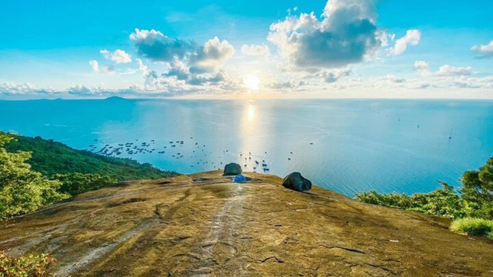
This area is characterized by large stacked rock formations, relatively steep mountain trails, and many sections requiring climbing assistance. Near the summit is an area called "tien san" (fairy ground), which has a rare flat terrain and a wide view of the sea. The combination of challenging terrain and natural scenery creates a unique attraction for trekking enthusiasts.
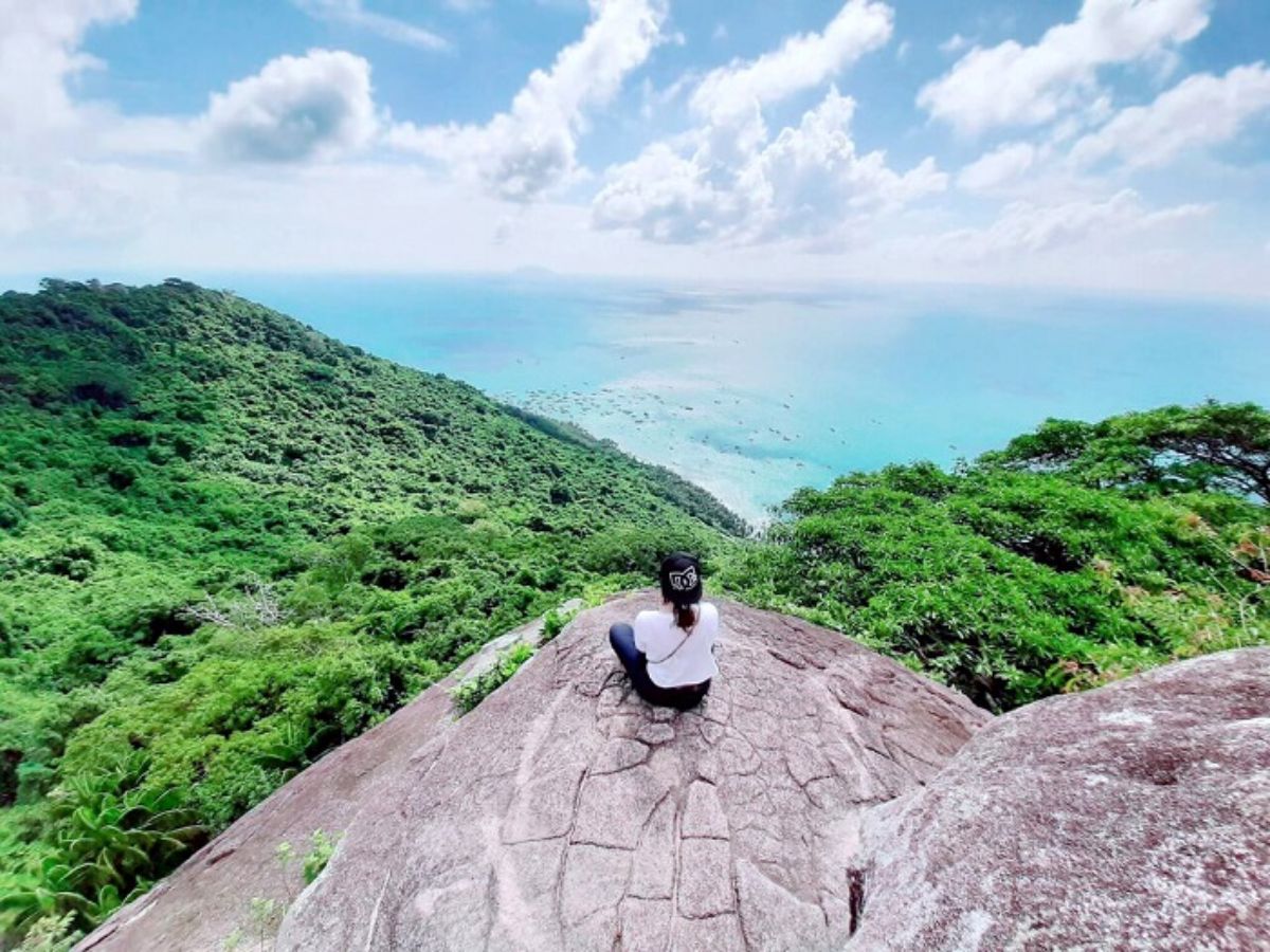
Ma Thien Lanh islet is located on Hon Son island, Kien Hai Special Zone. (Source: Collected)
1.2. Ma Thien Lanh Peak Hon Son and its appeal to trekkers
Ma Thien Lanh Peak on Hon Son island - An Giang is one of the trekking spots that many tourists are interested in when exploring the South. With an altitude of about 450 m, it is the highest mountain on the island, nổi bật with its natural terrain and wild landscape.
The attraction of this place lies not only in the climbing journey but also in the experience combining exercise and sightseeing. Tourists can conquer the mountain paths while enjoying the open sea space when going higher. The balance between challenge and landscape has made Ma Thien Lanh a suitable choice for those who love exploring nature in a more active and intimate way.
2. Ma Thien Lanh Peak Hon Son: a prominent trekking route in the South
2.1. Location, altitude, and terrain characteristics
Ma Thien Lanh Peak is located on Hon Son island, Kien Hai Special Zone, An Giang province, about 60 km from the mainland. It is the highest mountain in the terrain cluster on the island, with an altitude of about 450 m above sea level. The terrain in the area is mainly natural rocks interspersed with trees, creating continuous steep climbing paths and many narrow sections. The trail up the mountain is not too long but has distinct changes in terrain, from natural stone steps to sections requiring clinging to rock faces. This characteristic brings a clear sense of conquest, suitable for tourists who love trekking.
2.2. Why is it called the “roof of Hon Son”?
Ma Thien Lanh is called the “roof of Hon Son” because it is the highest point on the island, towering over the surrounding mountains. From the area near the summit, especially at the spot often called “tien san” (fairy ground), visitors can observe the panoramic view of the sea and nearby islands in favorable weather conditions. The open space and wide view create a different experience compared to lower trekking spots. This is also where many people choose to stop to rest and admire the scenery after their climb. The terrain combined with the landscape makes Ma Thien Lanh a symbol of conquest for Hon Son.
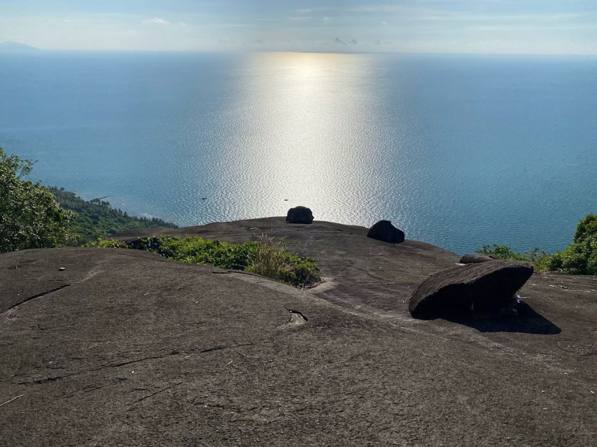
Ma Thien Lanh is the highest peak of Hon Son, with an altitude of 450 m. (Source: Collected)
2.3. Difficulty and conquest time
The journey to conquer Ma Thien Lanh peak usually takes about 2 to 4 hours for both ascent and descent, depending on physical strength and movement speed. The popular starting point is the area near Bai Bang, from where you follow the trail through the forest and natural stone steps to the summit. The difficulty of the trekking route is rated as medium to slightly difficult, suitable for people with stable physical strength and accustomed to outdoor activities. Some sections have steep slopes or slippery rocks that require careful movement. Preparing suitable shoes and drinking water is an important factor to ensure a safe and smooth journey.
3. What's special about trekking Ma Thien Lanh Hon Son?
3.1. The journey of conquest through forest, rocks, and "fairy ground"
The trekking route to Ma Thien Lanh starts from the Bai Bang area, following a trail through the forest and natural stone steps. In the beginning, the terrain is relatively easy to walk with dense tree cover, creating a cool feeling. As you go higher, the path becomes steeper, with many large rocks and sections requiring handholds for movement. A notable resting spot is the "fairy ground" area, a rare flat space halfway up the mountain. This is where climbers can rest before continuing their journey to the summit.
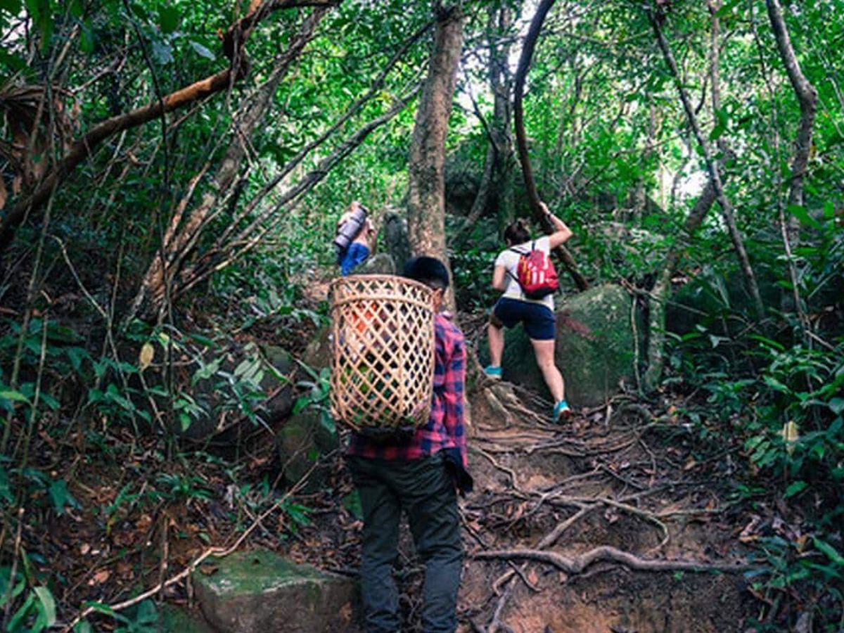
Ma Thien Lanh trekking route from Bai Bang area, following a jungle trail. (Source: Collected)
3.2. Notable check-in spots on the trekking route
Along the journey, Ma Thien Lanh offers many impressive viewpoints suitable for photography and sightseeing. The “fairy sân” area is a check-in spot chosen by many due to its protruding position, opening up a clear view of the sea. As you get closer to the summit, the space becomes wider with a panoramic view of Hon Son island and the surrounding sea. Additionally, sections of cliffs, jungle trails, or clearings between tree canopies also create many natural frames, suitable for outdoor photography enthusiasts.
4. Experience of traveling, staying, and eating when exploring Ma Thien Lanh Islet
4.1. How to get to Hon Son and the starting point for trekking
To explore Ma Thien Lanh Islet, tourists often travel to Rach Gia, An Giang, by bus from Ho Chi Minh City or nearby provinces, and then continue by high-speed ferry to Hon Son island. The ferry journey takes about 1.5 hours, with multiple departures daily, convenient for scheduling.
After arriving on the island, from the Bai Nha port area, tourists can rent motorbikes to travel to the foot of the mountain, usually the Bai Bang area. The distance is not too far, easy to travel, suitable for preparing for a day trek or combining with sightseeing around the island before climbing.
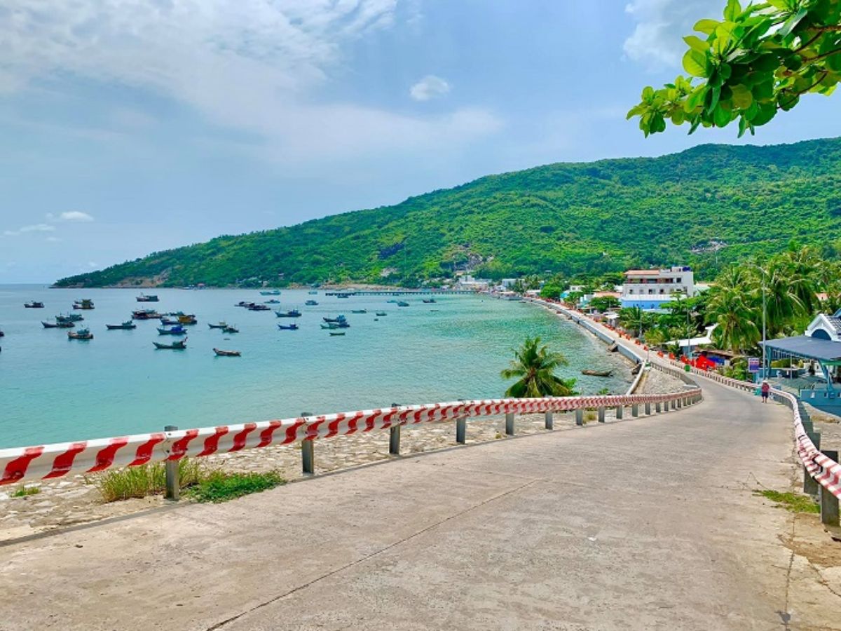
Tourists can easily travel to Ma Thien Lanh Islet along the coastal road. (Source: Collected)
4.2. Accommodation on Hon Son: a suitable choice for trekkers
Accommodation options on Hon Son are quite diverse, concentrated around Bai Nha and Bai Bac areas, suitable for various needs. Seaside homestays usually have reasonable prices, spacious environments, and convenient access to trekking spots.
Some places are chosen by tourists due to their proximity to the mountain base, easy to access early in the morning, while also offering common living spaces or outdoor areas. For those planning a trekking trip combined with a long stay, it is advisable to prioritize accommodation with support services such as vehicle rental or meal preparation. Booking in advance will help ensure a suitable choice, especially during peak seasons.
4.3. Dining on Hon Son with local seafood
The cuisine on Hon Son is an unmissable part of the experience when exploring Ma Thien Lanh Islet. The seafood here is mainly caught daily, offering freshness and a distinctive flavor. Tourists can easily find seaside eateries serving dishes like steamed fish, grilled squid, seafood hotpot, or simply prepared dishes that retain their natural taste.
Besides dining at restaurants, many tourists choose to buy fresh seafood at the market early in the morning and prepare it themselves at their accommodation. This method is suitable for groups of friends or families, saving costs and adding to the island exploration experience.
5. Suggestions for exploring nearby destinations of Hon Son
5.1. Discover beautiful beaches around Hon Son island
After conquering Ma Thien Lanh Islet, tourists can relax at the island's prominent beaches such as Bai Bang, Bai Nha, or Bai Duong. These areas boast clear blue waters, gentle sandy shores, and tranquil environments, perfect for resting, swimming, or watching the sunset. Combining trekking and relaxation makes the journey more balanced, especially for short trips.
5.2. Experience local life and coastal fishing villages
Beyond nature, Hon Son offers an intimate experience with the lives of fishermen. Tourists can visit fishing villages around Bai Nha or the harbor area to observe fishing activities, buy fresh seafood, or enjoy local dishes. The simple living spaces, slow pace of life, and friendliness are what many people love when exploring the island after a trekking journey.
5.3. Suggested itinerary extension to Phu Quoc
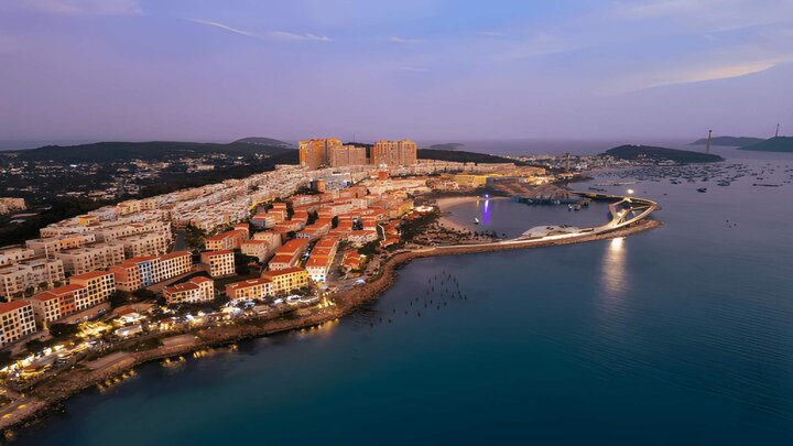
If you have more time, you can combine your trip from Hon Son to Phu Quoc, a prominent destination offering a diversity of resorts, nature, and entertainment. Here, beaches like Bai Truong, Bai Khem, or Bai Sao are chosen by many tourists for their clear blue waters, fine sand, and spacious environments, suitable for relaxing after a trekking journey.
Additionally, the South of the island features Sunset Town with its characteristic coastal architecture and sunset viewing spots. The Hon Thom cable car, nearly 8 km long, offers panoramic views of the An Thoi archipelago, connecting to Hon Thom island with Aquatopia Water Park and the Exotica village area. The combination of nature and entertainment experiences makes the journey more diverse and flexible.
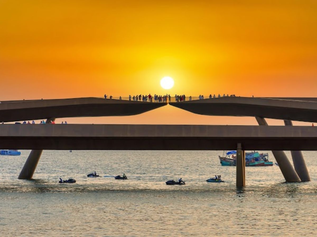
Experience watching the sunset on Cau Hon (Sunset Kiss Bridge), the most beautiful in the south of Phu Quoc island. (Source: Collected)
Ma Thien Lanh Islet is not only an attractive trekking spot but also opens up a journey to explore pristine nature amidst the islands of Kien Giang. From the mountain climbing routes to experiencing local life and nearby destinations, each stage offers a different perspective on the southern sea region. This is a suitable choice for those seeking a combination of activity and relaxation, while also wanting to fully experience natural beauty in a more active and intimate way.