















1. Introduction to Hon Nhan Kien Giang: Symbol of sovereignty amidst the Southwest sea
Located in the Tho Chu archipelago, Hon Nhan Kien Giang is a small rocky island belonging to the Tho Chu Special Zone. About 5 km southwest of Tho Chu island, it impresses with its characteristic stacked white rock structure, standing out in the waters of the Gulf of Thailand. With an area of only a few hectares and an average height of 23 to 40 meters, the island possesses a pristine beauty with few human traces.
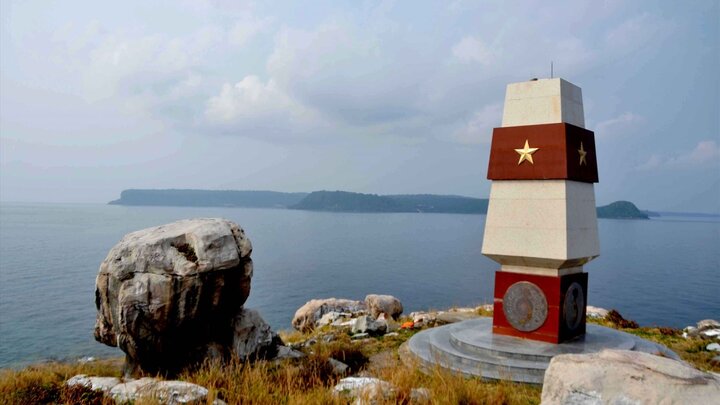
Not only does Hon Nhan possess a special landscape, but it is also point A1 in Vietnam's baseline system of territorial waters, carrying significant legal and maritime spatial meaning. Today, the sovereignty marker on the island has become a notable landmark, contributing to highlighting the historical value and special position of the Southwest sea area.
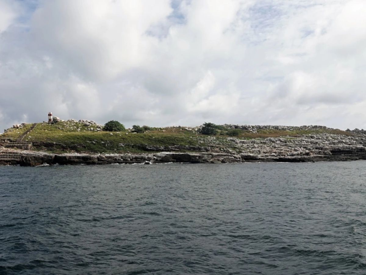
Hon Nhan Kien Giang is small in area but is point A1 in the baseline system of Vietnam's territorial waters. (Source: Collected)
2. Geographical location and natural characteristics of Hon Nhan Kien Giang
2.1. Geographical location within the Tho Chu archipelago and sea area linkage
Located within the offshore cluster of the Tho Chu archipelago, Hon Nhan Kien Giang occupies a special position on the Southwest edge, contributing to defining the sea space of the area. From here, direct connections can be made to maritime routes passing through the Gulf of Thailand, where many trading and fishing activities take place. The island is characterized by its isolation, being clearly influenced by seasonal monsoons and sea currents, making access highly dependent on weather conditions. This factor helps preserve its natural landscape and limits human impact, creating a sea space that retains many pristine features.
2.2. Geological structure and the formation process of the white rock island
The outstanding feature of Hon Nhan Kien Giang lies in its geological structure with characteristic layered white rock formations, formed through geological transformation processes spanning millions of years. Under the impact of sea weathering and wind, the island's surface exhibits numerous cracks, caves, and naturally stacked rock layers, creating a unique morphology. The white color of the rocks reflects strong sunlight, making the island easily recognizable from afar amidst the vast sea. It is this combination of geological factors and natural conditions that has created its distinct appearance, contributing to highlighting the island's scenic value in the region.
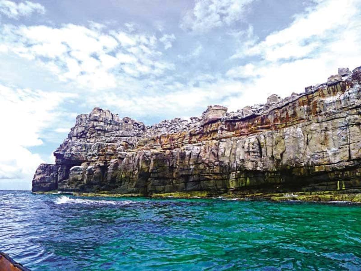
Geological structure of Hon Nhan Kien Giang with characteristic layered white rock formations. (Source: Collected)
2.3. Characteristic Ecosystems on the Island and Surrounding Sea
Although not large in area, Hon Nhan Kien Giang still maintains the characteristic ecosystem of a marine island environment. Vegetation includes salt-tolerant species like Barringtonia and sea hibiscus, growing on rocky terrain with high adaptability to wind and sun. The island is also home to swallows, which often gather seasonally, creating a vibrant yet characteristically tranquil landscape. The surrounding waters are clear and receive little impact from the mainland, providing a favorable environment for marine life to thrive. This natural balance contributes to the notable ecological value of the area.
3. Hon Nhan Kien Giang and its Historical Value, Sovereignty over Islands and Seas
3.1. Origin of the Name and Imprints in Historical Records
The name Hon Nhan Kien Giang originates from its natural characteristic, as many swallows frequently fly to nest on the island's white cliffs. This image has been recorded in local documents and some research materials about the Tho Chu archipelago. From early on, this area also appeared in the historical flow of the southern sea, associated with exploration and the expansion of living space at sea. These imprints contribute to its unique historical value, reflecting the formation and recognition of Vietnam's islands and seas through various periods.
3.2. The Role of Hon Nhan in the Baseline System of Territorial Waters
Within the system for determining maritime boundaries, Hon Nhan Kien Giang serves as point A1, the first point in the straight baseline used to calculate the width of Vietnam's territorial waters. This position was announced in the Government's Declaration on Baselines and complies with the provisions of the 1982 United Nations Convention on the Law of the Sea. Consequently, this area helps clearly define the scope of maritime zones and legitimate management rights over the southwestern sea. It also serves as an important basis for organizing sustainable management, exploitation, and protection of marine resources.

Hon Nhan Kien Giang serves as the first point in the straight baseline used to calculate the territorial waters of Vietnam. (Source: Collected)
3.3. Formation, development, and protection process of the island area
The Tho Chu archipelago area, including Hon Nhan Kien Giang, has gone through many stages of formation and development associated with administrative management activities and stabilizing residents' lives. Since the early 1990s, resettling people in Tho Chau has contributed to restoring the community and promoting the local marine economy. Concurrently, construction, protection, and environmental preservation activities on the island have been implemented, including the establishment of sovereignty markers and planting trees adapted to sea wind conditions. These efforts contribute to maintaining long-term natural values and affirming the area's role in Vietnam's maritime space.
4. Travel experience to Hon Nhan Kien Giang
4.1. Instructions for traveling from the mainland to Tho Chu
To reach Hon Nhan Kien Giang, visitors need to travel to the Tho Chu archipelago first. From Ho Chi Minh City or Hanoi, you can fly to Phu Quoc, then travel to Bai Vong or An Thoi to catch the HQ-09 high-speed ferry. Ferries usually depart on fixed days of the month, with a travel time of about 4–5 hours. Alternatively, from Ha Tien or Rach Gia, you can take a fishing boat with a more flexible schedule, but you need to contact in advance and prepare personal documents for procedures at the port authority or border guard. Proactively checking the ferry schedule will make the journey smoother.
4.2. Traveling from Tho Chu to Hon Nhan
From Tho Chu island, visitors can rent a motorboat from fishermen at the pier to go to Hon Nhan Kien Giang. The travel time is usually 20 to 30 minutes, depending on wave and weather conditions. Before going to the island, you need to contact the local authorities or the Border Guard Post for guidance and permits. Travel should be done during calm seas, especially in the dry season, to ensure safety. It is advisable to travel in small groups and have local support for convenience in arranging transportation.
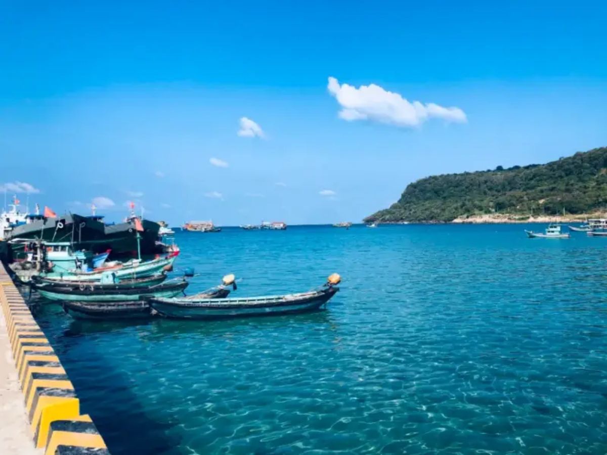
Tourists travel by small boat from Tho Chu to Hon Nhan. (Source: Collected)
4.3. Notes when planning a visit to Hon Nhan
When planning to explore Hon Nhan Kien Giang, it is advisable to prioritize calm seas to ensure safe travel. Tourists need to prepare fully with drinking water, sun protection, seasickness medication, and monitor the weather forecast before the trip. During the visit, it is necessary to follow the instructions of the authorities, do not climb cliffs, and do not impact the natural environment and ecosystem on the island. Preserving the landscape, minimizing waste, and traveling in small groups will contribute to protecting the pristine beauty of the area.
5. Outstanding experiences at Hon Nhan Kien Giang
5.1. Exploring the stone steps and A1 landmark
One of the notable experiences at Hon Nhan Kien Giang is the journey up the stone steps leading to the A1 landmark area. The rugged stone steps along the island's slope create a gentle sense of conquest, while also opening up a wide view of the surrounding sea. From above, the Gulf of Thailand appears with its characteristic blue color, combined with the white rocky terrain to create an impressive scene. The A1 landmark is not just a resting point but also a special mark, making the exploration journey more meaningful and memorable.
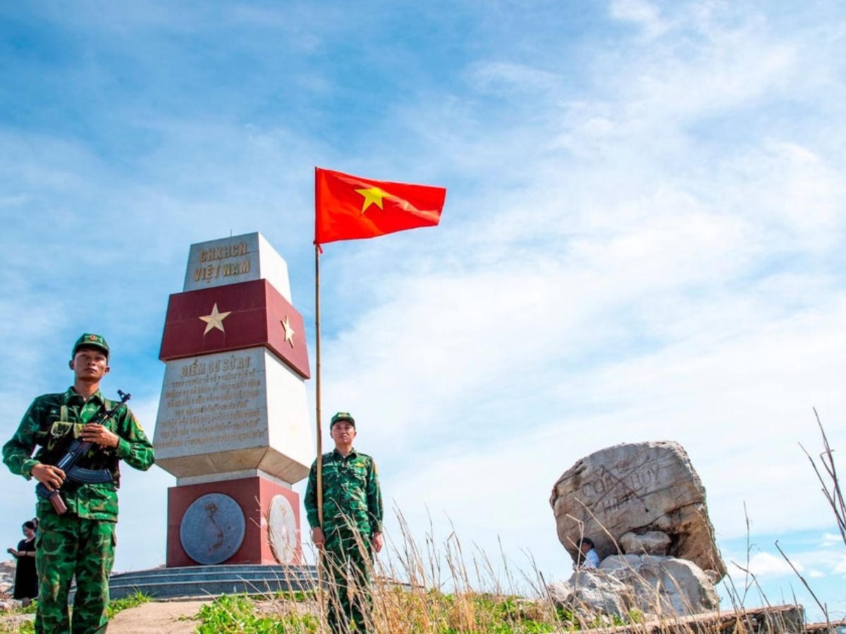
Many tourists come and check-in at milestone A1, on Hon Nhan island in Kien Giang. (Source: Collected)
5.2. Admiring nature and observing sea swallows
From afar, Hon Nhan Kien Giang stands out with its shape like a white rock mass amidst the blue water, changing shades according to the light of the day. Early morning or late afternoon offers favorable lighting conditions for observation and photography. This area is also a seasonal habitat for sea swallows, often appearing in flocks on the cliffs. When visiting, tourists should maintain an appropriate distance, avoid making noise, and prioritize observing from afar to protect the natural habitat of the birds.
5.3. Experiencing a visit to Hon Nhan Kien Giang
The journey to Hon Nhan Kien Giang is colored with an exploration of limits, where each experience is linked to the pristine nature of the sea and islands. Tourists often travel by small boat from Tho Chu, visit for the day, and spend time feeling the quiet space, separate from the usual rhythm of life. Activities such as sightseeing, photography, or bird watching take place in a nearly untouched natural setting. The limited number of visitors and travel conditions have contributed to preserving its rustic beauty, making each trip more complete and memorable.
6. Suggested itinerary combining exploration of Tho Chu and Hon Nhan
Day 1: Ha Tien – Tho Chu – Explore Tho Chu Island
The journey begins from Ha Tien, where tourists travel by boat to the Tho Chu archipelago, which still retains the peacefulness of a remote sea area. After settling into accommodation, one can spend time exploring the clear blue beaches, visiting fishing villages, and experiencing the simple life of the local residents. In the afternoon, the island's atmosphere becomes gentle with the sunset stretching across the sea, suitable for walking and relaxing. This is an ideal time to prepare for the journey to the distant island the next day.
Day 2: Tho Chu – Hon Nhan – Experience the distant island
From Tho Chu, tourists travel by small boat to Hon Nhan Kien Giang, a journey taking about 20–30 minutes depending on sea conditions. Upon arrival, one can spend time visiting the A1 milestone area, climbing the stone steps, and admiring the panoramic sea view from above. The quiet, secluded space makes the experience special, suitable for nature lovers. Additionally, tourists can take photos, observe sea swallows, or simply enjoy the rare pristine beauty before returning to Tho Chu within the day.
If there is more time, the itinerary can continue in Phu Quoc with diverse experiences, combining relaxation and exploration. Tourists can start by traveling to Sun World Phu Quoc via the Hon Thom cable car – a sea-crossing cable car route nearly 8 km long, offering a panoramic view of the southern island's sea and sky from above. From the cabin, small islands and the blue water gradually appear, creating an impressive experience right from the journey.
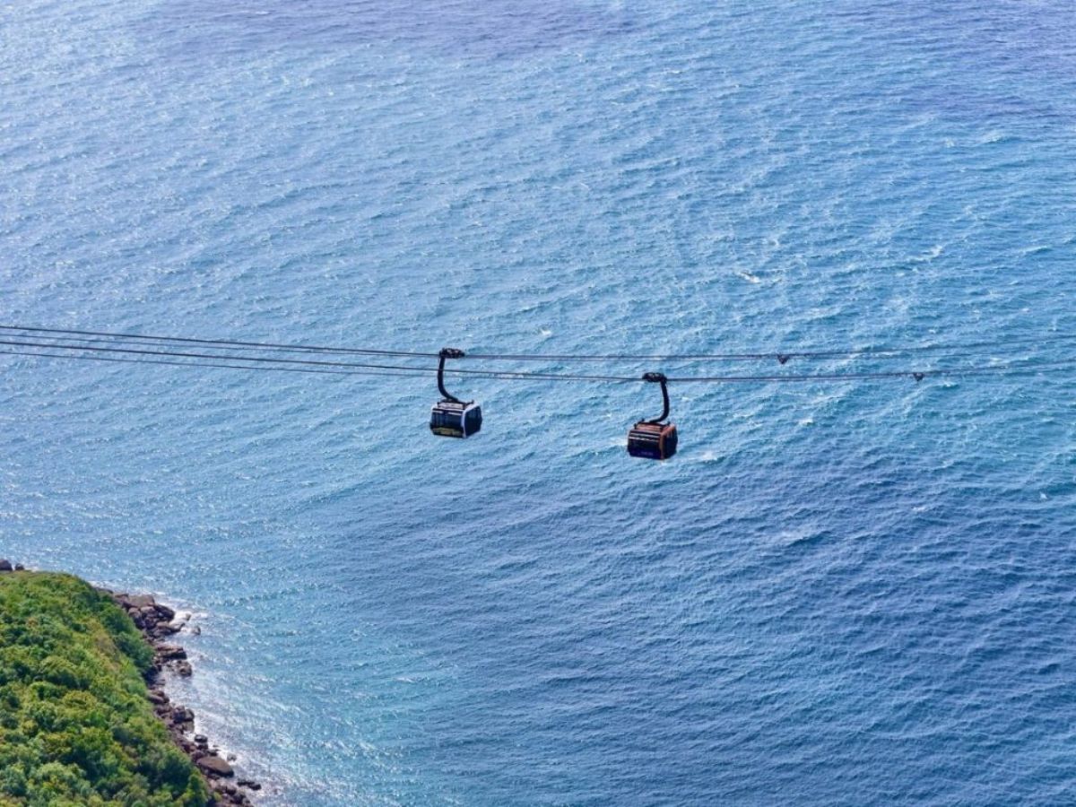
Tourists experience the Hon Thom cable car route crossing the sea for nearly 8 km. (Source: Collected)
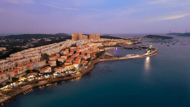
In the South Island area, Sunset Town impresses with its Mediterranean architecture facing the sea. Visitors can stroll around the square, admire the Central Village Clock Tower, the “King of The Sun” fountain, or visit the art exhibition space at Sun Signature Gallery. The highlight of the area is the Kiss Bridge, an ideal spot to watch the sunset over the sea. When night falls, shows like “Kiss of the Sea” or “Ocean Symphony” offer entertainment experiences combining light, music, and modern performance technology.
Hon Nhan Kien Giang is not just a rocky island in the sea but also a destination with many values in terms of landscape and experience. From the journey of travel, exploring nature to the distinctive imprints of the Southwest sea region, this place offers a different feeling compared to familiar tourist spots. Each trip not only stops at sightseeing but also contributes to raising awareness of environmental preservation, so that the island's pristine beauty is always maintained over time.